
Hikers Log - trail date: day 52
(Wapiti Shelter (mile 618.2) - Rice Field Shelter (mile 644.2))
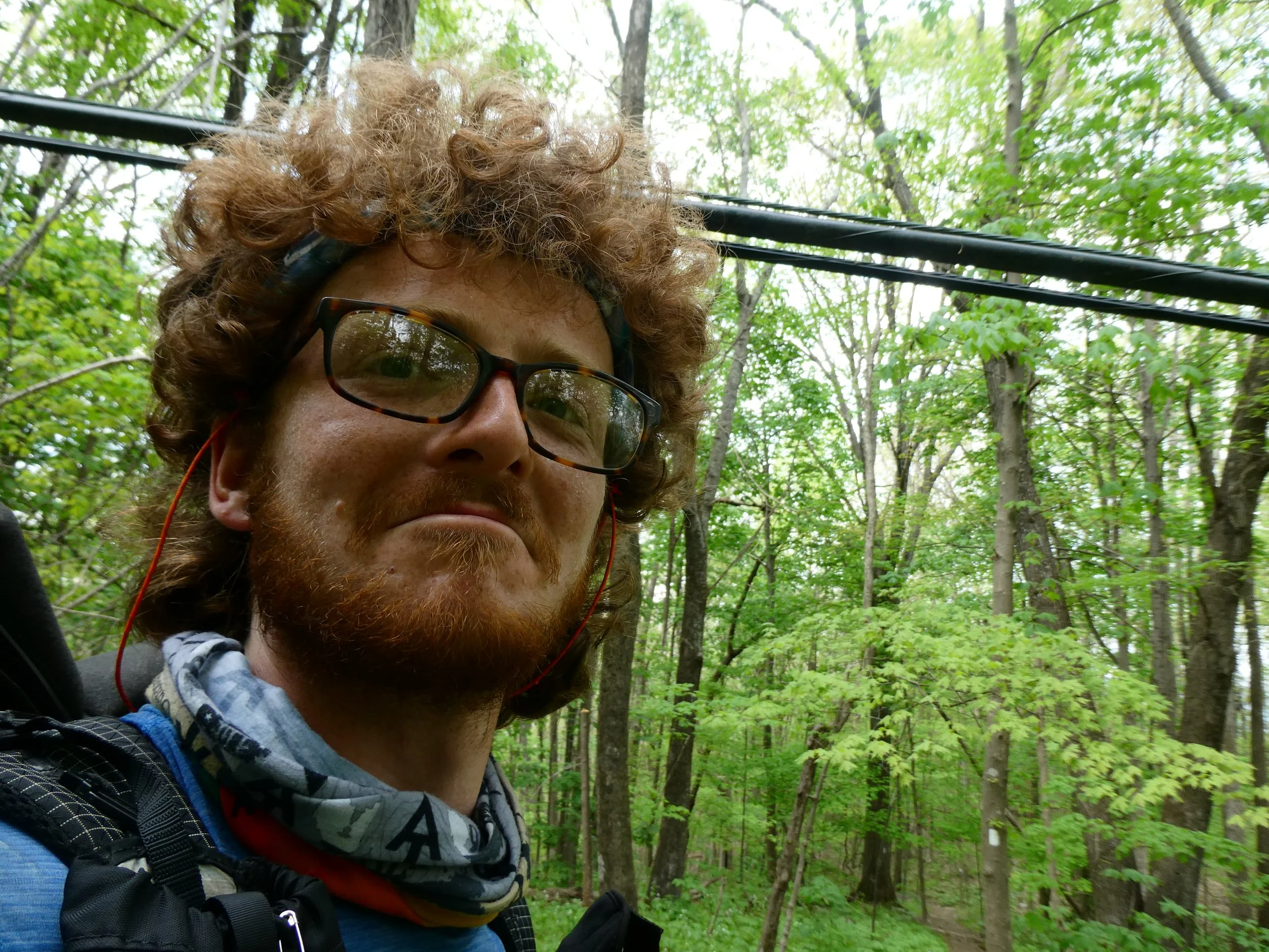
I woke up at about 7am and ate breakfast with a thru hiker couple named “Roadtrip” and “Paradise.” The couple had been in their tent when I reached the shelter last night, so I was just meeting them now. Strangely, I realized I recognized them from Instagram. In the weeks before I started my hike, I had kept track of AT-related geotags and had seen them start their thru-hike at Amicalola Falls. They had started long before me, but explained that they hike slowly and had gotten off trail for a bit as well. After Roadtrip and Paradise started hiking, I chatted with Doc, who gave me his phone number told me he and his wife would offer me a place to stay when I got to Rockfish Gap Just south of Shenandoah National Park.
I started hiking around 8:30am. I passed Roadtrip and Paradise just before the last spring before a 8.2 mile water carry. I climbed for a mile and was rewarded with excellent views over an area which Guthook identified as the Wilburn Valley.

Early morning panorama overlooking the Wilburn Valley
The goal for today is to pull a hero in and out of Pearisburg, which was 17.4 miles from Wapiti Shelter. A relatively short 0.7 mile road walk should get me into town, where I’m hoping to secure a small supplemental resupply. I expect it should take me five days to get from Pearisburg to the next resupply in Daleville, so I need an extra day of food. Ideally, I would like to set up camp at a stealth site near the road into town, walk in, resupply, grab dinner at Dairy Queen, and get out of town. There are almost always campsites near roads, so I think this should be doable even though there’s nothing marked on Guthook or AWOL. We shall see.
Over the next 6 miles, the trail continued lazily along the ridge, passing over the Ribble Trail blue blaze and Big Horse Gap Road. At mile 625.5, I crossed the road leading to Wood’s Hole Hostel, one of the oldest and most iconic hostels on trail. Started in 1986, Wood’s Hole is now famous for its organic, partially homegrown meals and free afternoon yoga class, offered every day at 4pm. I felt a little sad to be passing Wood’s Hole without a stop, but that’s just how it worked out. So it goes.
At mile 626.8, I noticed a small sign marking a short side trail to a “VIEW↑.” I took a chance and was glad I did. I was treated to a wonderful panorama of the Wilburn Valley, this time looking towards the southeast. Directly to the south, I could see the ridge I had been hiking earlier this morning. As I made my way back to the trail, I spotted a garter snake which quickly darted away through the leaves.

Today I passed Wood’s Hole Hostel, one of the most famous hostels on the AT. Unfortunately, I was only a couple miles into the day, so I decided to hike on

I always stop for views

Definitely worth a stop :)
After another mile I reached Doc's Knob Shelter, where I stopped to eat lunch. As I was eating, a thru-hiker couple reached the shelter accompanied by a black lab. They introduced themselves as John and Tracy, clarifying that they had not yet found suitable trail names. They introduced their canine companion as “Aurora.” I learned that John and Tracy were students at MIT who had taken a gap year to work and thru-hike. I asked if they had met Delta. They hadn’t, although they had heard there was another MIT student thru-hiking this year. As I finished my lunch, John noticed someone’s abandoned bear line stuck in a tree in front of the shelter. Apparently, he always tries to get bear ropes unstuck whenever he finds them. I watched with bewildered amusement as John attempted to get the rope out of the tree. When I left the shelter to continue hiking, he was still at it. I never learned if he was successful.

Doc’s Knob Shelter, with a very conveniently located spring right in front under the porch

I stopped for Lunch at Doc’s Knob, elevated my legs, and let my feet breath
The next 3.7 miles beyond Doc’s Knob Shelter involved more rolling ridge hiking through forests thick with rhododendron. Through this section I listened to the album “Strange To Explain” by Woods. This is the eleventh studio album from Woods, but the first and only album that I’ve listened to. I like it quite a lot. It’s a folky, psychedelic, and dreamy album, with a generous serving of mellotron. As the band name might suggest, this is good music to listen to in the woods. After passing under a huge set of powerlines, the trail offered excellent views to the east for the next 2 miles, culminating in the Pearis Ledges.


Excellent views from the Pearis Ledges

Today has been hot, and the trail has been super dry. Just beyond the Pearis Ledges was a blue blaze to a reliable spring. I needed water, but unfortunately the spring was 0.2 miles off trail. I sucked it up, dropped my pack, and hurried down to the spring. After collecting water, another half mile brought me to the short side trail for Angel’s Rest, a pride-rock-type outcrop with excellent views overlooking Pearisburg. After admiring the views, I stopped to dig a quick cat hole as I made my way back to the trail.

Water has been super sparse today, so I sucked it up and made the 0.4 mile round trip for water

View from “Angel’s Rest” overlooking Pearisburg
I ran into John, Tracy, and Zero when I finally returned to the trail, and we hiked together for the descent into Pearisburg. As we made our way down the ridge, John and Tracy discussed their ultralight philosophy. They’re way more strict than I am. Case in point, they also received AT hang tags from Paperclip, but decided not to keep them because the tags registered on their scale (surely a fraction of a gram😂). Consequently, their packs are TINY. They don’t even need hip belts!

This power line draped precariously low over the trail, it was maybe only a couple inches above my head
After 2 miles of downhill, we reached the first road into town, which supposedly leads directly to Dairy Queen. I had been on the lookout for stealth sites, but none presented themselves, so I opted to take the 0.7 mile road walk with Zero. The walk was easy, and sure enough, we were lead directly to DQ. But before I could grab ice cream, I needed to stop at Food Lion to grab my small resupply.
After Food Lion, I returned to DQ, where I found John and Tracy. The restaurant was closed to indoor dining, so we joined the line of cars for the drive-thru. I ordered two small Blizzards and a 6pc chicken tenders basket. We sat at tables in front of the DQ where I ate both Blizzards and opted to pack out most of the tenders and fries. As we were about to head out, Push appeared and I explained that he needed to join the drive thru line to order. As I was chatting with Push, Tracy flagged down a truck and asked if we could hitch a ride back to the trail. I hopped in the truck bed with Tracy, John, and Aurora and we were soon back at the trail head.

After grabbing some dinner at Dairy Queen, I hitchhiked out of Pearisburg with two fellow thru-hikers, John and Tracy, along with their hiking companion Aurora
Over the next mile, I chatted with John and Tracy about my research interests, including frogs, chytrid, and CRISPR. We passed a small waterfall and soon made it to the second road into Pearisburg. There, we encountered a large group of thru-hikers gathered in a parking lot. I didn’t recognize any of them, but John and Tracy did. The group was zeroing in Pearisburg at an airbnb. They had a puppy with them. I have no idea where it came from, but the image of a girl sitting in the grass, puppy in her lap, rolling a giant blunt will live rent free in my mind for the rest of my life.
John and Tracy stayed to chat with the group and I hiked on. I took a wrong turn and ended up in an old cemetery watched over by an ancient white oak. I backtracked and was soon back on trail. A short 0.3 miles brought me to US Route 460 and a large bridge over the New River.


I took a wrong turn and ended up in an old graveyard featuring an ancient white oak
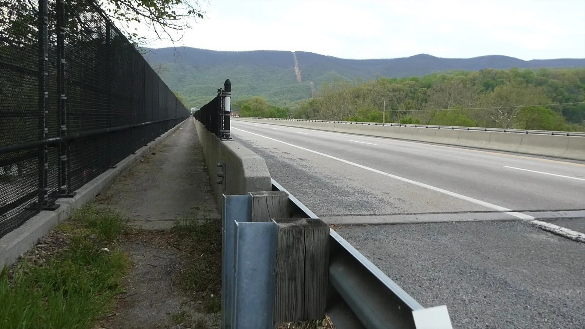
The trail routed over a huge bridge crossing the New River

This chemical plant just outside of Pearisburg smelled absolutely awful and made the last few miles pretty miserable!
Beyond the bridge, the trail routed past a rank-smelling chemical plant. The climb out of town was rough. Not only was there a lot of uphill, but the smell of a nearby landfill hung thick in the hot afternoon air, filling my lungs and making me feel ill. There was a stream about a mile beyond town, but spooky signs warned about pollution from landfill run-off. This section of trail sucked. There’s no polite way to put it. There were gross reminders of humanity everywhere I looked. Trash, old fencing, and that god-forsaken smell! I had already hiked over 18 miles today and I was tired. I had hoped I could find a campsite on the outskirts of town, but the smell and lack of clean water forced me onwards and upwards. The afternoon was hot, I was thirsty, and I was chafing like crazy. I tried using Vaseline to minimize friction, which maybe helped a little. Emphasis on “maybe.”

Stairway to heaven

After 5.8 miles of climbing, as the sun was fading in the sky, I made it to the first clean water source beyond Pearisburg. I had been out of water for a while. I sat on a rock, and chugged the cool spring water. I was exhausted.
After another 0.6 miles, I made it to Rice Field Shelter at about 8:20. To the north, I could see the lights of a small town which I later learned was Peterstown. There was enough residual light to hang a bear bag. Barely. I’m not sure why I even bothered. I ended up setting up my tent in the dark, which was huge pain in the ass given the darkness, my own exhaustion, and the rock-infested ground. Eventually, one bent Easton stake later, I was successful. I crawled into my tent and gobbled down my remaining chicken tenders and fries. As I ate, I heard John and Tracy arrive. Today was by far my longest day of hiking. Including the walk into town and all my blue blaze detours, I easily hiked over 27 miles! Sleep came easy despite strong winds.
Into Pearisburg just to get some Dairy Queen then back to the trail