Hikers Log - trail date: day 37
Zero day at Boots Off Hostel & Campground

Zero day at Boots Off Hostel & Campground

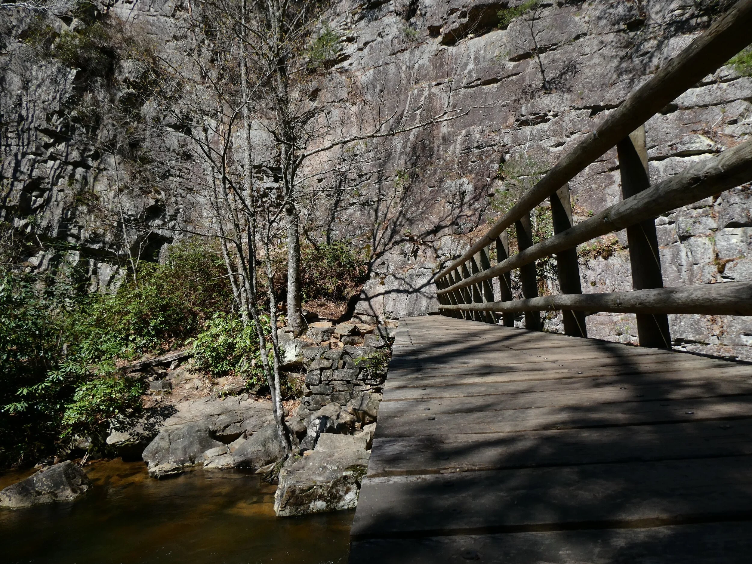
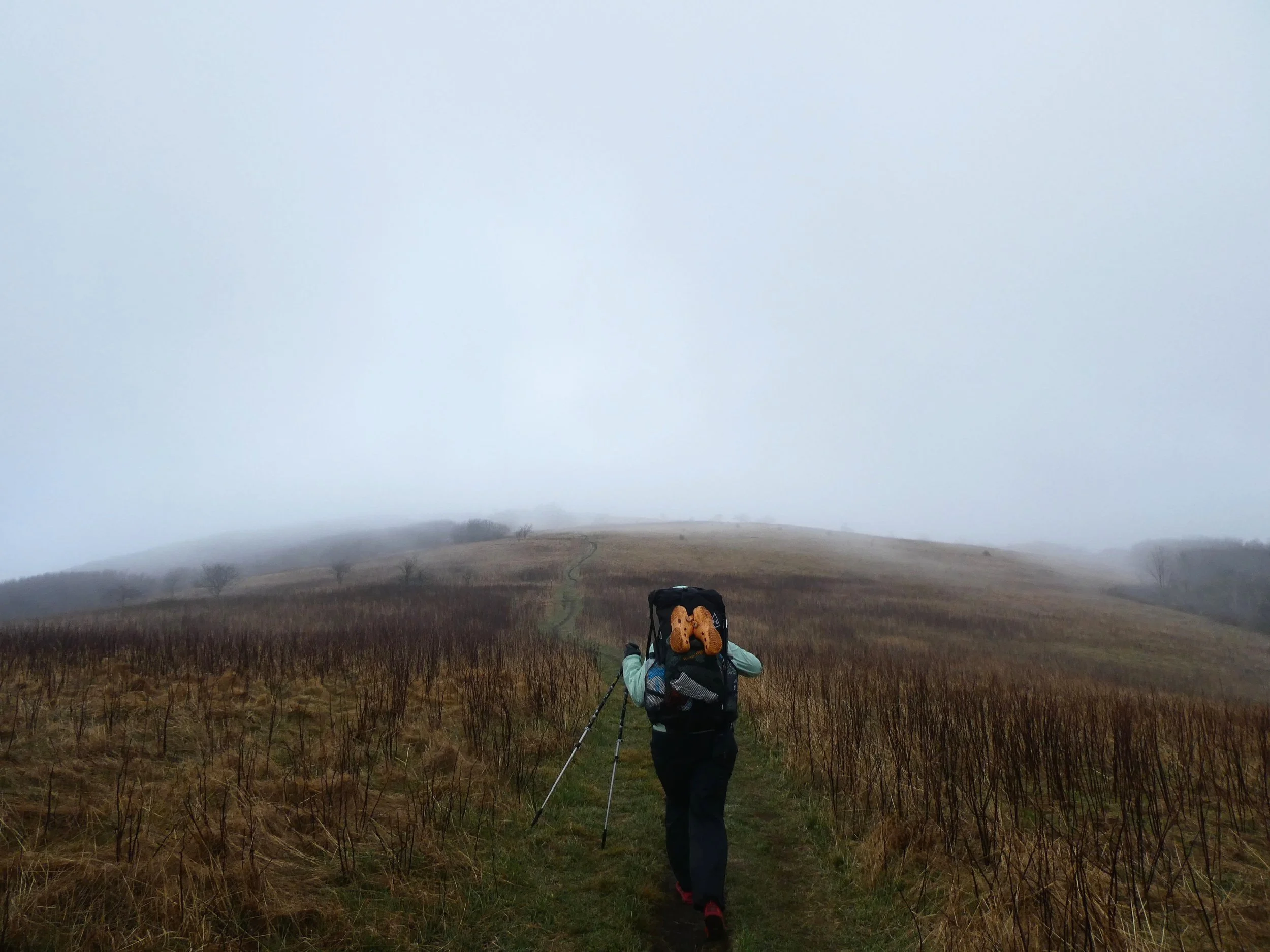
I briefly thought I had lost the trail until I realized it skirted around this cliff on a tiny rock ledge next to the river
(Moreland Gap Shelter (mile 413.7) - Boots Off Hostel & Campground (off mile 428.4) *overnight at Boots Off*)
I woke up a little after 7:30am and took my time with breakfast in camp before hitting the trail about an hour later. After making it over 18.5 miles yesterday, the plan was to get to Boots Off today. I felt pretty confident I would be taking a zero day at Boots Off. The primary reason for a zero day would be to allow myself the opportunity to finalize grad school plans.
This morning I received a text from Dr. Anna Savage at the University of Central Florida. Dr. Savage informed me that she was next in line to receive a grad student teaching assistantship, and was hopeful that she could soon offer me a spot. For context, I only applied to two grad schools. The University of Central Florida, where I would be advised by Dr. Anna Savage, and The University of Alabama, where I would be advised by Dr. Gui Becker. I already received an offer from UA and have been waiting to hear from UCF. Over the last few weeks, I’ve been leaning more and more towards UA. The research seems cool and the stipend is better. In fact, I already have a signed copy of the UA offer letter on my phone. However, given this new information from Dr. Savage, it seemed like an offer from UCF was in the works, so I needed to consult with my mentors, family, and Anna Claire to get their thoughts. The University of Alabama expects an answer by April 15th (three days from now), so I have time but I’ll be cutting it close.
A zero day would also give me a chance to rest my knee a bit. The elevation profile on Guthook showed a lot of downhill today, so I hoped my knee would cooperate. Whatever happens, I’m definitely going to seek out a knee brace in Hampton.


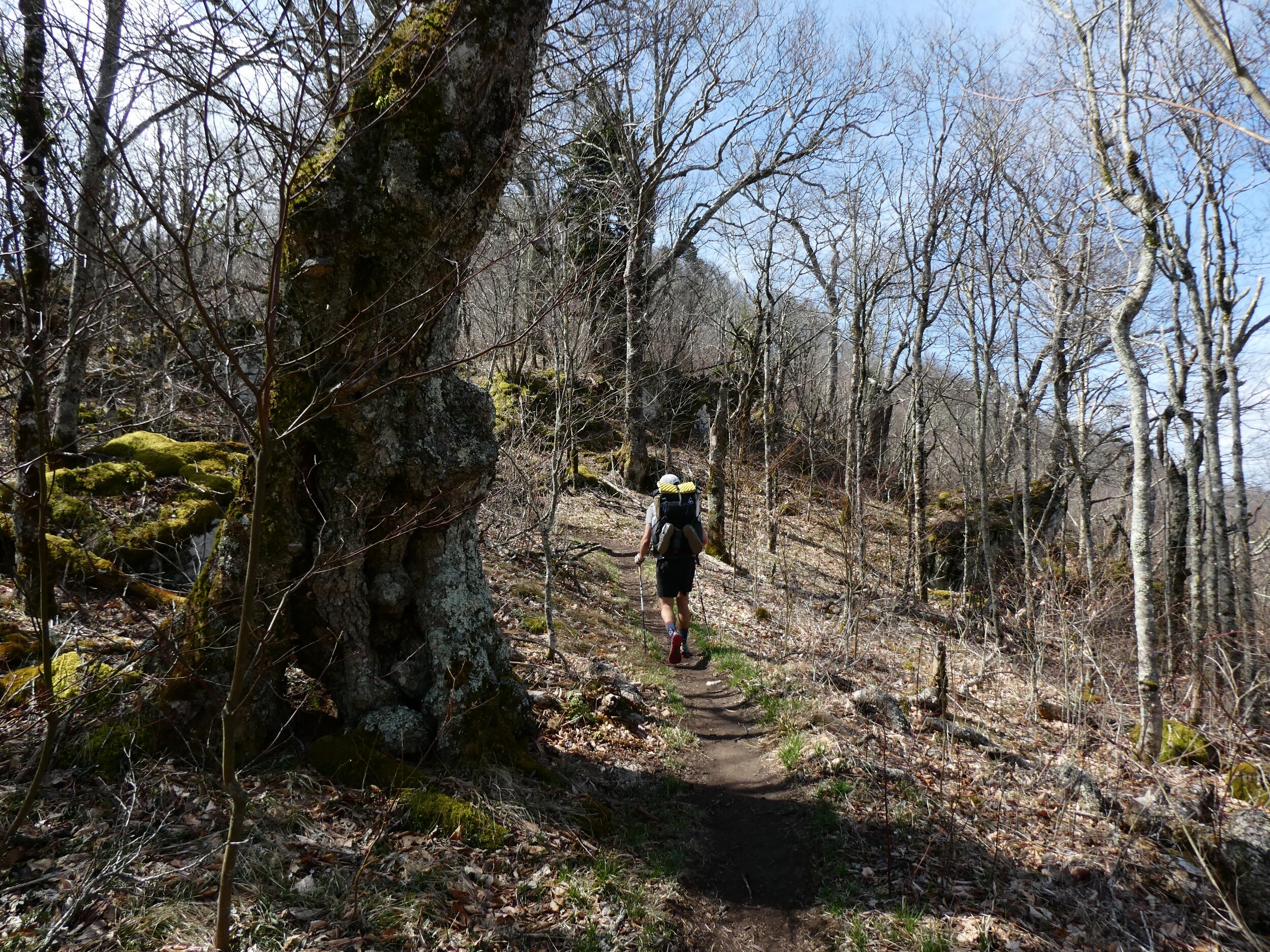
After 2 miles, I stopped at a water source to eat my apple and orange. While there, I met a thru-hiker named “Saltlick.” The next 4 miles were mostly a gradual downhill, peppered with an occasional small view through the trees. I passed an old dilapidated log cabin on the banks of a small pond before crossing Dennis Cove Road and entering the Pond Mountain Wilderness. The trail followed along the Laurel Fork River, eventually leading into Laurel Fork Gorge. Dramatic rock walls rose on both sides of the trail as the trail wound deeper into the gorge.
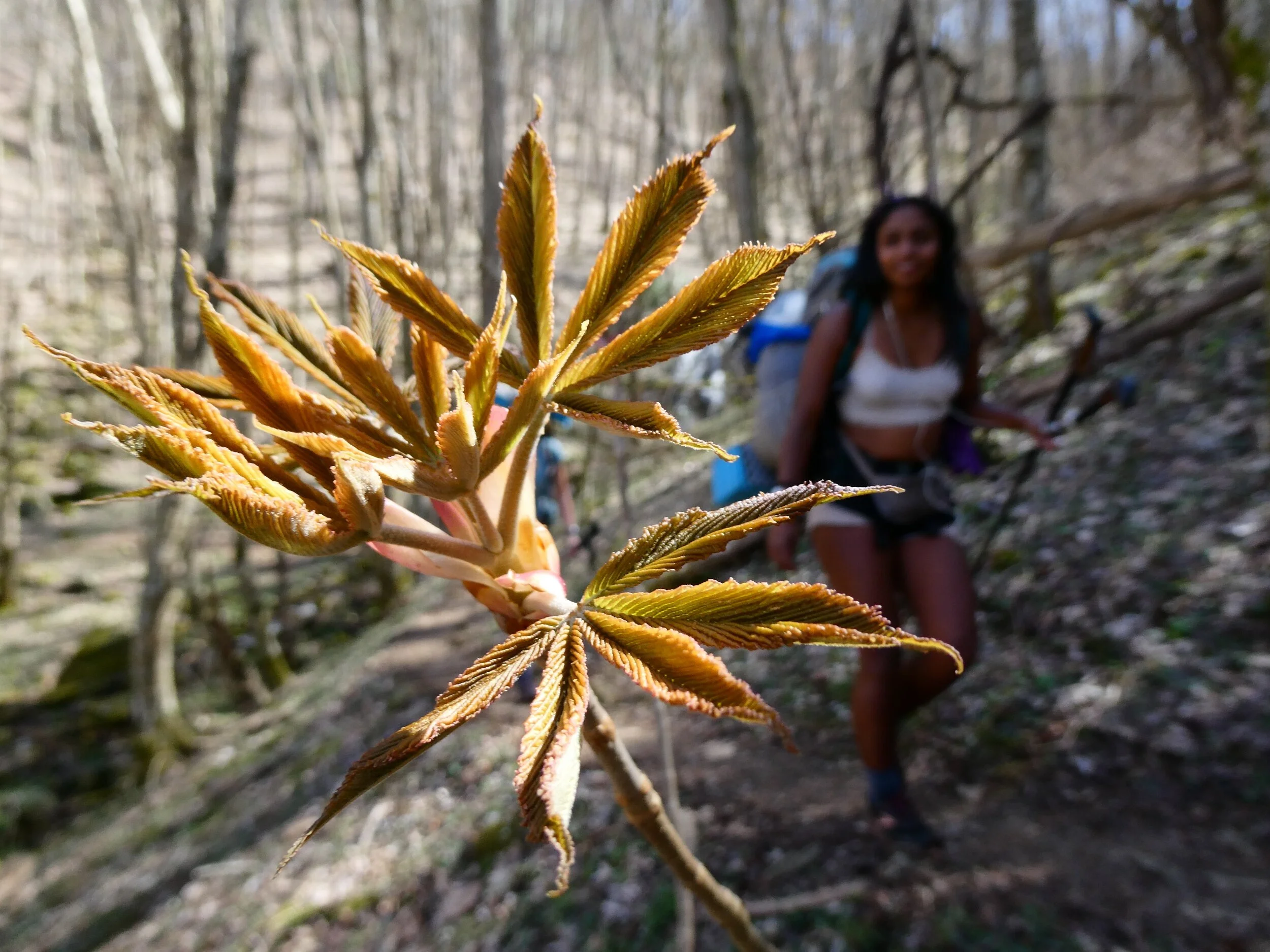
As I entered the gorge, I curated a playlist of every Lil Wayne song on my phone. This included a collection of songs from my middle school iPod (peak bling era Wayne), providing plenty of hype as well as a lovely musical excursion down memory lane. Standout tracks included “Go DJ” from the original Tha Carter (2004) and “Paradice” from Rebirth (2009 - which was Lil Wayne’s excursion into rock-rap). The trail passed over the Laurel Fork River on an absolutely massive wooden bridge. I stopped to take pictures of the bridge and noticed a small art installation on one of the bridge’s supporting pillars. I returned to investigate and felt like I had discovered an AT easter egg.

Laurel Falls
The trail routed into the gorge, descending steeply down an awkwardly spaced stone staircase towards Laurel Falls. My knees had been doing pretty good this morning, but the stone steps were far from comfortable. I decided to stop at the falls for lunch. The waterfall was huge, and its thunderous roar echoed up the gorge walls. Today was another beautiful day, and I basked in the sun at the base of the falls.
The trail followed Laurel Fork downstream and seemed to dead end as the river wrapped around a massive cliff. I thought I must have missed a turn-off until I noticed a blaze painted on a tree near the cliff. Sure enough, the trail skirted around the cliff on a narrow ledge only a few feet above the river. The trail climbed quickly towards a shelter side trail and then descended again to continue alongside the river. After crossing the river two more times via beautifully engineered wooden bridges, the trail finally started an extended climb out of gorge.

The next 3 miles were one long, hot, dry climb. Fortunately, I had Lil Wayne to keep me company. The sweet sounds of Tha Carter V (2018) motivated me over the last mountain before Boots Off. Tha Carter V was released long after the peak of Wayne’s relevance, but I think it served as fitting proof of his continued influence, charisma, and dynamism. Not every song on the sprawling, 1hr 30min project was perfect, but it certainly hyped me up and kept me stepping. Personal highlights included “Uproar,” “Can’t Be Broken,” “Demon,” and “Mess.”
After summiting Pond Flats, I spotted a garter snake on my way down towards Hampton. About 3 miles later, I made it to Shook Branch Road and completed the short road walk to Boots Off Hostel & Campground.

I stopped at Boots Off Hostel & Campground to make my grad school decision official. I will be attending the University of Alabama in the fall to pursue my PhD in biology

The shower stalls at Boots Off where I did my laundry while showering

My tentsite at Boots Off

🎊🍾 400 miles 🍾🎊
(US Route 19E (mile 395.3) - Moreland Gap Shelter (mile 413.7))
Although I could have used a little more sleep, the hostel was already crawling with activity at 7:30am and I begrudgingly rolled out of bed. I packed my things and made my way down to the dining room where the free breakfast was served at 8am. I helped myself to two heaping plates. The first was loaded with buttermilk pancakes and the second sagged under the weight of biscuits, gravy, hashbrowns, and bacon. Nothing fancy, just a hefty southern breakfast. There have been few moments on trail when I struggled to finish a meal. This was one of those moments. Fear not however, I was eventually victorious🤤
I grabbed an apple and orange to go and loaded onto the 9am shuttle back to the trailhead. It was a quick trip, and the shuttle driver used it to explain how we had finished the "hard part of the south." In my short time on trail, I’ve noticed that people spew a lot of *cough* *cough* bullshit. Things like: “If you make it to Hot Springs, you’ll finish the trail” or “Virginia is basically flat.” I’ve learned to take these statements with a mountain of salt, and I mostly ignore them.
I got dropped off and decided to sit at the trailhead and enjoy my apple. To my surprise, an SUV pulled over across 19E and Delta hopped out with his parents. Apparently, his 21st birthday was a couple days ago and his parents and sister drove down from Cumberland to celebrate with him. They opened the trunk of their SUV to reveal a bounty of food. His mother offered me a slice of very tasty strawberry pie, as well as a banana, orange, apple, and some Nutty Buddys, which I packed out. Hopefully, packing out the fruit will help me get some extra vitamins in my life. As we were gobbling up the pie, Katie and Jasmine arrived, who also helped themselves to the spread. After we had eaten our fill, I stayed behind to finish my morning stretches while Delta, Katie, and Jasmine headed down the trail.
My plan was to make it 33 miles to Hampton over the next 2.5 days or so. I was hoping to stay at Boots Off Hostel & Campground outside of Hampton. Boots Off has a reputation as one of the nicest hostels on the trail, with $15 tentsites, $5 full service laundry, free showers, and a town shuttle. It sounds like a nice spot.
As I began hiking, I could tell that my knee was still tender. Fortunately, the terrain was mild, with a gradual climb over the first 3 miles or so. The first interesting landmark of the day was Isaacs Cemetery, an old local cemetery which the trail passed through at about mile 398. After two miles and two small road crossings, I looked up and noticed “400” painted on a tree to the left of trail! Another milestone🥳🍾
About a mile later, I reached the short spur trail for Jones Falls and noticed Delta, Katie, and Jasmine’s packs lying beside the trail. I found them eating lunch at the (very large) waterfall and joined in on the fun.

Jones Falls
We hiked on together and Katie asked me a lot about frogs. I’m always happy to chat about frogs😁 After yesterday’s crazy weather on Big Hump, today was warm and sunny. We rounded a corner and I spotted a garter snake basking in a small patch of sunlight to the left of the trail. This was the first snake siting of my hike and the little guy was polite enough to pose for a few pictures. Eventually it grew fed up with the attention and slithered away into the brush.

The trail entered Sugar Hollow, routing us through a series of narrow fields beside the Elk River for about a mile. Wildflowers flaunted their colors beside the trail while butterflies seemed to curiously flutter by. I spotted a large water snake with keeled scales (maybe a northern water snake) which quickly darted into the river.
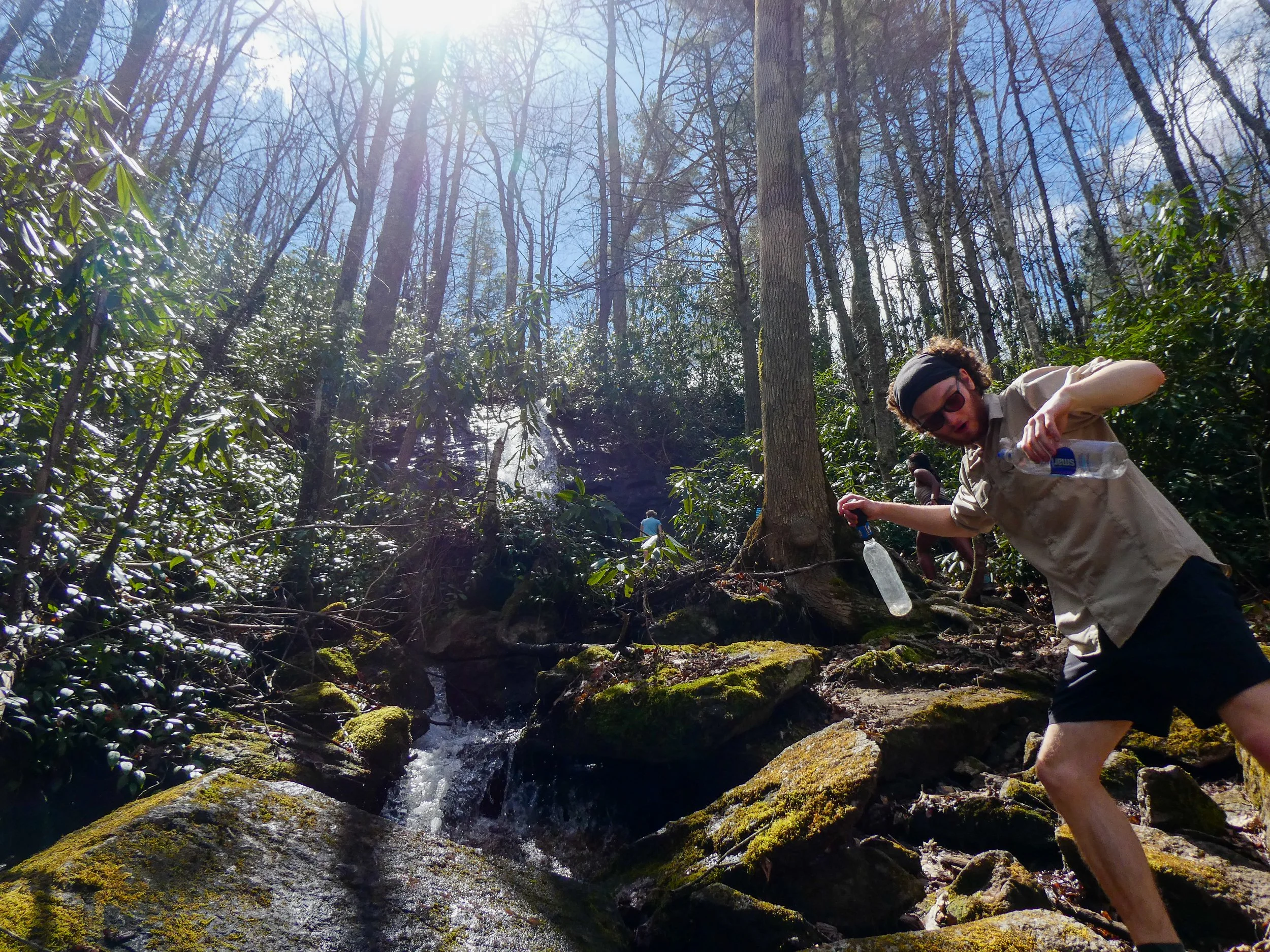
After another 2 miles, the trail passed the base of Mountaineer Falls, a large and scenic waterfall. We stopped briefly to collect water and check out the falls.
Delta at the base of Mountaineer Falls

Mountaineer Falls


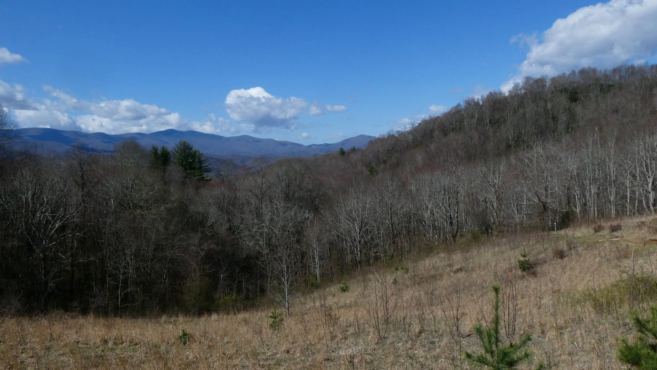
A nice view from a small bench at mile 407.5
The trail continued lazily over the next 6 miles. The area was beautiful, with abundant rhododendrons and regular creek crossings. We chatted extensively about food (as hikers tend to do), favorite movies, and Jasmine invited us to visit her parents on Long Island whenever we make it to New York. We were promised more food then we could ever eat, as well as her fathers infamous YouTube video marathon. I thought it sounded great!
We reached HARDCORE CASCADES, a series of small waterfalls named after Bob People’s legendary “Hardcore Trail Crew,” which is a large volunteer trail maintenance crew that performs trail work each year during the Trail Days celebration in Damascus, VA.


Delta admiring an overlook

Moreland Gap Shelter
After another 3 miles, we finally reached Moreland Gap Shelter, making it a nearly 18.5 mile day. I didn’t expect to make it this far today, but the easy terrain, beautiful sites, and good company made it feasible. It really was a great day, with three different waterfalls, two rivers, and two snakes.
During dinner, I chatted with a group of middle-aged weekenders who were occupying the shelter. One of them owned a Dunkin Doughnuts and another had such bad blisters that he had opted to abandon his too-small boots and instead hike in three pair of socks. During Dinner, Katie and Jasmine busted out their Flamin’ Hot Cheetos Craft mac n’ cheese, which was disturbingly red and apparently very disappointing.
Side note - I pooped four times today. The huge breakfast at the station probably helped, but maybe I should also ease up on the olive oil😅


Hiking over Hump Mountain
(Overmountain Shelter (mile 386.1) - US Route 19E (mile 395.3) *overnight at The Station*)
It rained most of the night. When I finally crawled out of my tent, I discovered that a cloud must have fallen. The entire ridge was enveloped in a heavy fog. Ominous yet beautiful.
My plan for the day was to hike about 9 miles to US Route 19E. Once I reach 19E, I can choose to go left, which will take me to Mountain Harbour Bed and Breakfast - or I can choose to go right, which will take me to The Station at 19E. Two iconic hostels, each with their own personality. Mountain Harbour is the classier establishment, with $30 single bunks and a $13 breakfast which has been voted “best on trail” over ten years in a row (not sure what authority conducts such a vote, but we’ll take their word for it). The Station at 19E is a bit more chaotic. It’s a pub, restaurant, and music hall with 400+ craft beers and live music on Saturday nights (tonight!). I honestly had no idea whether I would choose left or right. My plan was to get to 19E and just follow my gut.

Woke up this morning in a cloud

I started hiking with Puddin, Clover, Excel, Katie, and Jasmine. We immediately started climbing out of Yellow Mountain Gap towards the summit of Little Hump Mountain. As we climbed the cloudy fog thickened and the wind gusts grew aggressive. Visibility was limited which gave the impression of false summits at the edge of our visibility. So many false summits. One after another.

Little hump rising through the fog
As we neared the summit of Little Hump, the trail grew increasingly rutted. The main path was more of a muddy, eroded canyon, which put major strain on my ankles. I tried to walk in the main rut as much as possible to minimize erosion, but I found myself straying to the side more and more. Poor trail etiquette I know, but better than a strained ankle.
Despite the tricky footing, Little Hump was beautiful in the fog. At the summit, I stopped to let the crew pass ahead of me. I needed to take a quick pit stop, but more importantly, I wanted to hike in solitude for a bit. Hiking in a group can work magic for the spirits, but this morning, I needed to drink in the atmosphere for myself.
As I descended from Little Hump, I entered a forest which offered some relief from the wind. After about 2 miles of descent, I made it to the open face of Bradley Gap, which sits between Little Hump Mountain and Big Hump Mountain. Poetic nomenclature, for sure😂
As I continued on, the wind and rain really picked up. Visibility reduced even further. I experienced wind gusts unlike anything I’ve felt before. As I climbed Big Hump, I felt my body being pummeled by the wind. It was as if my torso was a sail, catching each gust, threatening to lift my feet from the muddy, rutted path. I felt vulnerable and exposed. All I could do was keep moving forward. It was a humbling and strangely beautiful experience.
More than any other moment yet, I felt like I was being tested by the trail. As if this was some crucial moment in the heroes journey of a thru-hiker. I was crossing the threshold and plunging deep into the unknown. Everything felt so real. I felt the adrenaline in my system, tinged with a bit of fear. I laughed a lot too.

The wind was crazy today. At some points it was so breezy that I struggled to walk straight!


A good tree

The descent from Big Hump was also wooded, offering relief from the wind. After about 2.5 miles of mildly graded descent, I reached Doll Flats, which is where the trail leaves NC for good. I finally had a second state under my belt!🎉🎊
Shortly after Doll Flats, I caught up with the crew and the downhill grade grew much steeper. The downhill really hurt my knees, and I made a mental note to try and ice my knees this evening.

After 3 miles of knee-aching descent, we made it to 19E. The choice of left or right was made for me as the entire crew turned right. They were headed for The Station and I followed. After a half mile road walk, we made it to The Station at 19E. The rain was heavy and the place was packed. I ended up securing a mattress in the loft space of an open common room for $30. I’m still trying to be COVID cautious these days, which generally involves avoiding shelters or shared bunk rooms at hostels, but sometimes the trail just isn’t conducive to caution. The loft space was not exactly socially distanced accommodations, but my need for a dry place to sleep won out over the nagging voice of Anthony Fauci in the back of my mind. Laundry and a free breakfast were included in the price, which eased my conscious even further.
After a shower, I paid a visit to The Station’s gear/resupply pantry, which was essentially a closet filled with overpriced Snickers, Ramen, and Slim Jims. The resupply left a lot to be desired but I managed to scrounge together enough to make it work. In the common area, I found a handful of cooking supplies and random ingredients that had been abandoned by earlier hikers. I assessed my options, and ended up making tuna mac in the hostel kitchen. Katie and Jasmine tried some and thought it was good until I shared that I had used mayonnaise for extra creaminess (in my defense, you couldn’t taste it - I was just being resourceful😂).
Lots of new and familiar faces began arriving at The Station. Most of The Little Hotties were staying, including Gunga-Din, Disco, and a rather gregarious fellow named “Aquaman.” I also met a duo of hikers named “Fox Trot” and “Ghost,” who had been hiking with Push for a while. Lastly, I met a couple going by “5 Pounds” and “Swiss Miss.” 5 pounds earned his name because he carries 5 pounds of fire breathing supplies. Like, a literal circus side show act (which I never saw, unfortunately).
In all the chaos, it was nearly impossible to find a quiet place indoors. I eventually discovered that the basement laundry room was fairly disturbance free. So I called AC and we talked for a couple hours as I elevated my leg against a washing machine, iced my knee, and popped ibuprofen.
As the resident laundry room goblin, I ended up switching many hikers laundry from washer to dryer. This unexpectedly paid off later in the evening as Excel and 5 pounds offered to buy me beers for doing their laundry. The Station’s pub carried over 400 craft beers and I was presently surprised to find that they carried Sam Smith’s Chocalate Stout, which is my favorite beer. Excel bought me their last bottle and I joyously quaffed it down. 5 Pounds bought me a local Coffee Stout which was fine but forgettable.
For dinner, I was hoping to order something heavy with vegetables, but as far as I could tell, they didn’t offer many non-fried veggies on the menu. I ended up ordering a French dip per Excel’s recommendation, which was basically a Philly cheese steak with a side of onion broth soup for dipping. It was hardy and satisfying. I drank, ate, and chatted with my fellow thru-hikers while a local bluegrass took the stage and did their thing.

Clyde Smith Shelter AKA “The Barn”
(Clyde Smith Shelter (mile 370.5) - Overmountain Shelter (mile 386.1))
I woke up around 7:30am and took my time to pack and eat breakfast in camp. The plan for the day was to hike about 16.5 miles to “The Barn,” which would take me over Roan Mountain and through the southern portion of the Roan Highlands. I’ve heard a good deal about the Roan Highlands. They are supposed to be beautiful. I started hiking around 9am and began the first climb of the day to Little Rock Knob Vista. The ~1 mile climb to the Knob was well graded, and even though my left knee was still feeling tender, the climb felt good. As I stopped to admire the views, Excel caught up to me and we hiked together for a mile or so.

View from Little Rock Knob
I hiked on without Excel after a water source about a mile past the knob. I crossed Hughes Gap Road and started the climb up Roan Mountain. The climb involved a ~2,200 foot ascent over about 4.5 miles. Shortly after the gap, I stopped at a piped spring and got passed by Lebowski. I caught back up to Lebowski and hiked with him to first false peak about halfway up Roan. We chatted and learned that he is married and from Columbia, South Carolina, where he works at a gear shop called Halfmoon Outfitters. Lebowski was planning to meet his wife this morning at Carver’s Gap, just over Roan Mountain. So he was hiking hard and fast. I enjoyed the pace, but bid Lebowski farewell when I needed to stop to dig a cathole.
A very big old tree (Lebowski for scale)

After my pit stop, I continued the climb up Roan Mountain, which was graded beautifully. Whatever trail crew that maintains this section had done a great job. The trail was wide, featuring many stone steps that were well spaced - a rare feature that I did not take for granted. The forest was enchanting, and I enjoyed the solitude as I climbed.
I stopped for lunch at the top of the mountain and was joined my the rest of the crew. We ate in a grassy field which was once the site of the Cloudland Hotel, a massive 19th century resort. Signage at the site explained that the hotel was built about 1884 and catered to pleasure-seekers and those suffering from hay fever. Very little of the original structure remained, but the field made for a lovely picnic spot on such a beautiful day.
While we were eating, we met “Gunga-Din,” a thru-hiker whose trail name was a (purposefully misspelled) reference to the Rudyard Kipling poem. He had earned it after collecting water for an older hiker. Gunga-Din was a big guy. Hailing from Minnesota, he was part of the “Little Hotties” trail family, a group that I had heard of but hadn’t met yet.
I hiked on with the crew and we decided to stop and check out Roan High Knob Shelter, the highest shelter on the AT. The double-decker shelter was a bit off trail, but at 6,270 feet above sea level, it was only about 20 feet lower than Mount Washington. This, of course, is in terms of absolute elevation (relative to sea level). In terms of prominence (elevation relative to surroundings), Roan Mountain has nothing on Mount Washington.
At the shelter, we ran into Gunga-din and a couple others from the Little Hotties crew, including “Disco,” who recently started wearing sun gloves to combat a weird reaction she was having to the sun. Her hands were pretty gnarly, covered in welts that resembled a major poison ivy reaction. I’ve been experiencing a much milder version of her symptoms on my hands as well. Like me, Disco’s hands were not itchy. Most thru-hikers use a lot of hand sanitizer on trail, and a physician suggested that excessive hand sanitizer might be making Disco’s hands sensitive to sun exposure. Who knows, but Disco seemed to think the gloves were helping🤷♂️

Roan High Knob Shelter, the highest shelter on the AT (elevation 6186 feet)
I hiked on without the rest of the crew. At Carver’s Gap I ran into trail magic from a gentleman named Don. Don handed me a banana and offered to make me a pimento cheese sandwich, which I gladly accepted. Don explained that he was from outside Charlotte as I lounged in one of his folding chairs and gobbled down my pimento cheese sandwich. I bid Don farewell just as Puddin, Clover, Excel, Katie, and Jasmine were arriving.

Trail magic from Don
I crossed the road and entered the much anticipated Roan Highlands. After trying and failing to find cell service all day, I finally had enough bars to get a call out to Anna Claire, whom I was missing dearly. We talked for a while and AC said she was going to ask the next weekend off to come see me. I’m a lucky, lucky guy.
As I began hiking again, I couldn’t help but watch nervously as dark rain clouds gathered to the south. I decided some music was needed to set a proper mood. I chose “Calamo” by Claudio Tallino, an ominously psychedelic soundtrack to a 1976 Italian erotic-thriller film. It was a good choice. I passed over Round Bald and Jane Bald while being buffeted by wind gusts and light rain. The surrounding landscape was beautiful. It felt like another planet. The views, weather, and music all contributed to a deeply surreal feeling, as if I was on the brink of reality. It was strangely moving.

Rain in the distance made for an atmospheric hike through the Roan Highlands

Jain Bald in the Roan Highlands
Despite the occasional rain and threatening thunder, the worst storm clouds blew past just a bit to my south and I seemed to be in the clear as I hiked off Jane Bald. Sure enough, it stopped raining and I was treated to a beautiful rainbow. Wait no… it was a faint double rainbow!!🌈🌈
As I admired the rainbow, a rabbit hopped across the trail nearby. My new furry friend didn’t seem to mind as I crouched to take its picture. Rainbows and a rabbit! It was a truly idyllic trail moment.

🌈 Double rainbow after a brief afternoon thunderstorm 🌈

This rabbit hopped across the trail while I was admiring the rainbows! Maybe my most idyllic moment on trail so far

Leaning trees
After another 2 miles, I passed Stan Murray Shelter which was overrun by a Boy Scout troop. I kept moving and made it to Overmountain Shelter 2 miles later. The Barn was unfortunately closed do to major structural instability, but the surrounding tentsites were great and I set up alongside Excel, Clover, and Puddin. Despite suspicious looking clouds, Katie and Jasmine were cowboy camping as per usual.
Overmountain Shelter featured an open concept privy with excellent views. The toilet seat cover was also bedazzled. I assume this was to ensure that hikers were pooping in style😂
The rain mostly held out, with the exception of a quick shower as everyone was preparing dinner. We ran for our tents for a couple minutes and then emerged to find an even more impressive double rainbow stretching across the bowl-like valley below.
As we ate, a man in all cammo arrived carrying a rifle. I asked what he was hunting and he explained that he was out for the start of turkey season. He was a nice guy and I enjoyed chatting with him🦃
Today was a good day.

The Barn is one of the most iconic shelters on the AT. Unfortunately, it is closed due to major structural instability. Still maybe the coolest campsite yet!

(Beauty Spot (mile 355) - Clyde Smith Shelter (mile 370.5))
The night was neither cold nor windy. I actually got a little toasty and had to undo my vestibule in the middle of the night. I woke up to Katie’s voice outside my tent: “Frogman? Frogman? Get up! The sunrise is awesome!” It was a little before 7am, and I poked my head out of my tent to find Katie, Jasmine, Excel, Clover, and Puddin. “Aren’t you getting up to see the sunrise?” Katie asked. Apparently the whole crew had left Curly Maple Gap Shelter at 4:20am to make it to Beauty Spot for the sunrise. I joined them and was happy I did. The sunrise was very pretty🌄

I packed my things, did my morning stretches, and headed to the water source 0.3 miles past Beauty Spot. I had just enough water to get me through dinner last night, which left me with maybe a tenth of a liter in the morning. Barely enough to quench my morning thirst. Definitely not enough to make breakfast. After gathering water, I ate breakfast on a log next to the trail. I hiked for another mile or so and stopped for water and a morning cat hole at Unaka Mountain Gap. The crew caught up and I decided to hike with them for the steep climb up Unaka Mountain.

An old disused hiker ladder. These structures are usually built to allow hikers to climb over barbed wire fences
As we neared the summit of Unaka Mountain, the forest transitioned to magical fantasy mode. Thick mats of moss covered the ground while old gnarled hardwoods peppered the stands of spruce and fir crowding the mountaintop. At times, the spruce formed a dense, claustrophobic corridor barely wide enough to pass through. Unaka Mountain is also known as the Emerald Forest. I could see why. It was striking. Many Lord of the Rings comparisons were made.

Hiking through an enchanted spruce forest on Unaka Mountain

My left knee has been tender since the morning I made it to Uncle Johnny’s. Nothing major, but I hope it won’t get worse. I should probably seek out a knee brace next time I’m in town to give everything a little extra support. My left shoulder was also a little sore around my vaccine site. No serious discomfort or other symptoms fortunately. Puddin was not so lucky, and has been experiencing mild COVID-like symptoms since his shot. He’s had COVID before, which apparently can make the post-vaccine experience a lot worse. I’m no vaccine expert though, so don’t quote me on that.
About 3.5 miles past Unaka Mountain, we stopped for lunch at Cherry Gap Shelter. The shelter’s most notable feature was a low-slung entryway which was labelled ‘THE DECAPITATOR (low clearance 5’ 6”)’ Fortunately, I avoided any head trauma. Jasmine busted out a huge back of fried Indian snack foods which her parents had sent her. They were delicious and immensely calorie-dense. After lunch, just as we were about to leave the shelter, Steve arrived. I figured Steve would be far ahead of us by now, so I was pleasantly surprised to see him.

After another 5 miles, the crew took a break in field near water source after Iron Mountain Gap. We were about 2 miles from a tentsite Iron Mountain, which was where the crew was hoping to make it tonight. That woul be just about a 20 mile day for them since they started at Curly Maple Gap Shelter. However, the afternoon sky was teasing rain, with ominous clouds and frequent wind gusts. They decided to push ahead to Clyde Smith Shelter (where I was headed) in hopes of avoiding a storm on top of Iron Mountain.
We took a break in a field to collect water and strategize about where to overnight
It started sprinkling soon after we got moving again. I tolerated it for a bit and then decided to put on my rain jacket. I kid you not, the moment I had my rain jacket on, it immediately stopped sprinkling. Ugh.
We made it to Clyde Smith Shelter around 5pm. After helping Excel hang her bear line, we all gathered around the fire pit for dinner. The Crew was understandably tired after their 22 mile day, but the rain had held out and spirits were high. As we were dining, a thru-hiker I hadn’t met yet arrived. The crew seemed to know him already, and he introduced himself as “Lebowski.” Lebowski has averaged 24 mile days this week and reminded me of Shia LeBeouf with a big, bushy beard. Steve also made it to shelter and it felt good to be surrounded by so many good souls.
Tomorrow my hope is to make it to Big Barn, an iconic shelter on the other side of Roan Mountain.

Dinner at Clyde Smith Shelter

(Uncle Johnny's Hostel (mile 344.2) - Beauty Spot (mile 355))
I woke up at a little before 8am to find that a bird had pooped on my tent. This is the kind of thing I expect to find on trail, not during my overnight in “civilization.” What a lovely way to start the morning😂
After cleaning off my tent, I ate two of my leftover doughnuts and left my stuff in my tent just in time to catch me and Katie’s 8:45am shuttle to Walmart for our vaccine appointment. Our shuttle driver was named Doug and we learned that he was a snake breeding hobbyist and avid herper (someone who enjoys seeking out reptiles and amphibians). We chatted about rattlesnakes and he quizzed me with a challenge to ID a pine snake - which I did.
Doug dropped us at Walmart and we had no trouble checking in for vaccine appointment. Everything was surprisingly casual, and the pharmacy accepted a picture of my insurance info on my phone. As far as I could tell, the vaccine was free and they just wanted the insurance info to help them keep track of who was getting vaccinated.
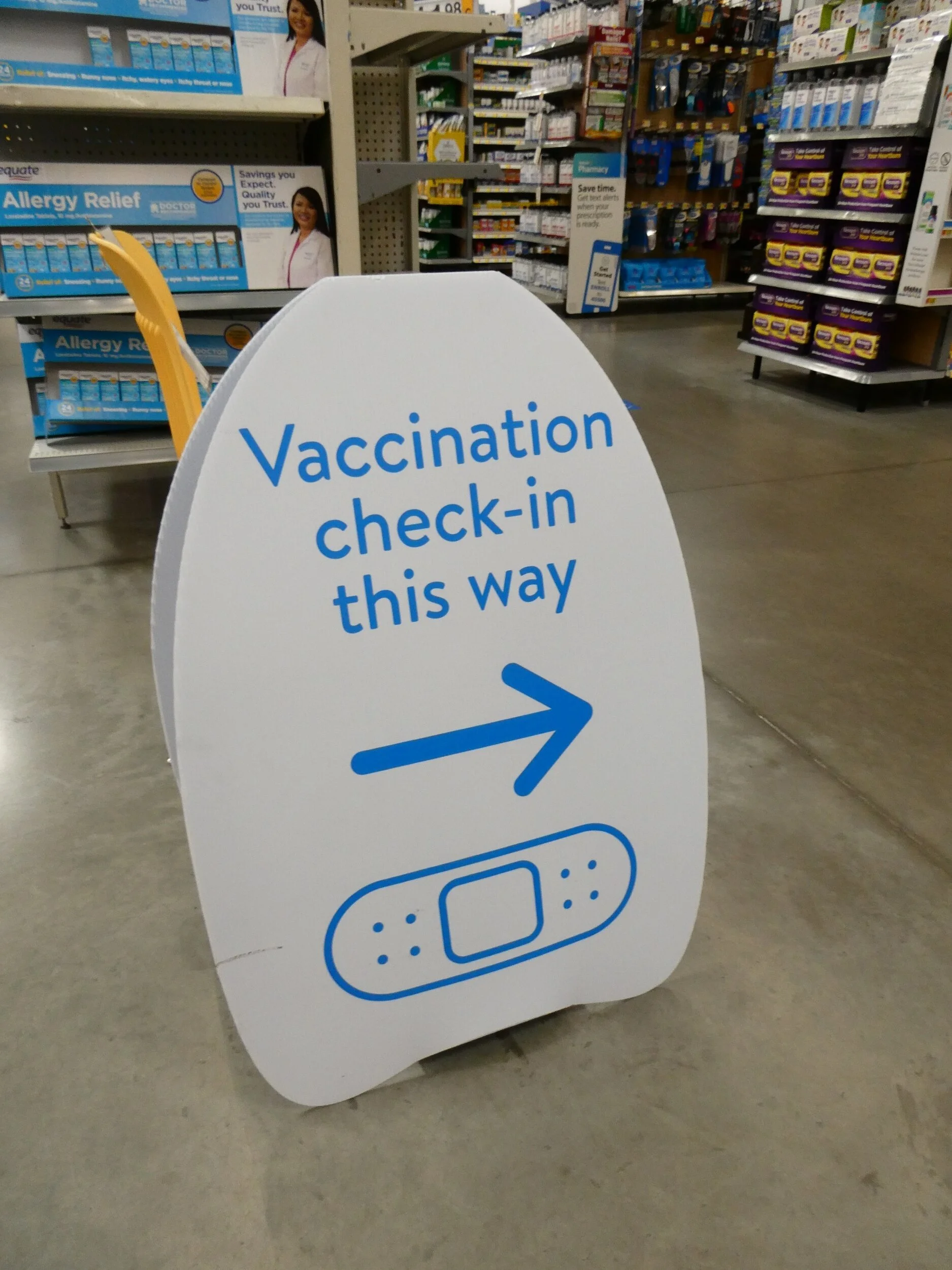
Last night I was unexpectedly able to book a COVID vaccine appointment at the Walmart in Erwin, Tennessee!

I got stabbed by a guy named Chuck who explained that I could just show my vaccination card for the second dose in 28 days. I was relieved to know that I wasn’t expected to get my follow up dose at the same pharmacy. Hell, in 28 days I’ll be somewhere in Virginia. Katie and I waited in the “make sure you don’t have an allergic reaction” chairs while I ate my last doughnut, an avocado, and a tangerine. Neither of our throats swelled after about 10 minutes, so we figured we were good to go.
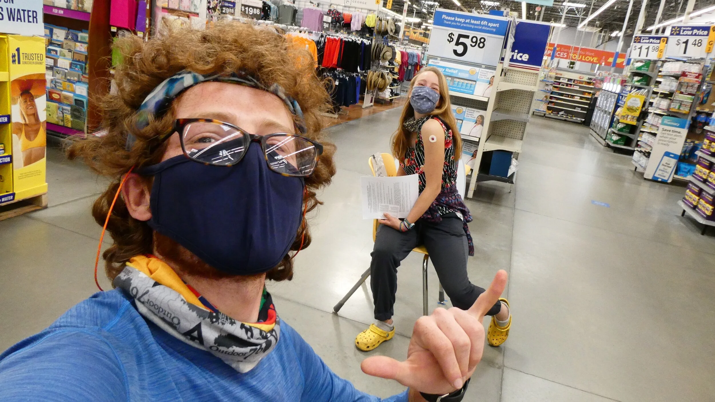
🎉 First shot down 🎉
Doug shuttled us back to the hostel and I packed my things while charging my phone and camera. I then sat around for a bit while eating extra food from Katie and Jasmine's resupply that they didn’t need. After eating my fill, I started hiking around 12:45pm. The afternoon sun was intense, so I applied my suncreen and crossed my fingers hoping to avoid a crazy sunburn. After crossing the Nolichucky River and some railroad tracks, the trail followed the river for about a mile. Things cooled off as the trail followed a creek for next 2 miles, then heated up again as I really began the climb from Erwin and the Nolichucky River.
The climb was intense. Rocky, hot, and dry. I’ve mostly been hiking in pants, but this afternoon, I was grateful for my shorts. I stopped for a late lunch at Curly Maple Gap Shelter where I met two thru-hikers from Pennsylvania. One of them, a bearded gentleman named “Mose,” carried a big mirrorless camera, which he said he was happy with. Maybe some day I’ll upgrade my trusty Panasonic point-and-shoot for a mirrorless design. Probably the Panasonic G7, because I’ve been super happy with my last two Panasonic cameras.
I left Curly Maple Gap Shelter around 3pm with about 6.5 miles to go until Beauty Spot, an apparently beautiful bald where I was hoping to camp depending on my water situation. There were a number of water sources in the next mile, then none until after Beauty Spot. I loaded up on water at the last stream after the shelter and hoped it would get me through the evening at Beauty Spot. If not, I would just hike on to the water source a little past Beauty Spot.

The rest of the afternoon involved a lot of climbing. The trail was wide and well-tread. For about 30 minutes I experienced some pretty intense gastrointestinal discomfort, which may have to do with the insane amount of fruit, berries, and dried fruit I consumed over the last two days. Fortunately, I was able to keep hiking and eventually the discomfort passed.

The soundtrack of my afternoon was Johanna Warren’s 2020 album “Chaotic Good,” which Anna Claire introduced me to after listening to her interview on the Mushroom Revival podcast. I enjoyed the album a lot and it set a mysterious, slightly ominous tone that made for good hiking. The weather had really mellowed out, and I expected a nice sunset from Beauty Spot.
Made it to Beauty Spot around 6:15pm. The views were incredible and I immediately knew I would be spending the evening on the bald. I was a bit disappointed to see a parking lot maybe 100 yards from the summit, but I had the bald to myself at the moment. The summit wasn’t too windy, so I set up my tent nearby the summit with the short end oriented toward the wind. As I was setting up my tent, I noticed black flies for the first time since I’ve been on trail. They mostly buzzed around me annoyingly, but a couple also had the audacity to bite. I pulled on my rain racket and pants for a little extra bug protection and hung my bear bag near the parking lot. I then ate my pad Thai ramen dinner while breathing in the views. Lots of cars started arriving with folks eager to watch the sunset. There was even a couple taking engagement photos with a professional photographer. I took a time lapse of the sunset, and crawled into my tent. Today was a good day.

Set up my tent on Beauty Spot, a really gorgeous bald that is popular with day hikers


Uncle Johnny's Hostel outside Erwin, Tennessee
(Spivey Gap (mile 333.1) - Uncle Johnny's Hostel (mile 344.2) *overnight at Uncle Johnny's*)
I left Spivey Gap at 7:00am with the goal of reaching Uncle Johnny’s by noon. The hostel offers shuttles into Erwin three times a day, so I assumed one of those times must be noon. I felt confident I could make it ~11 miles in five hours. My pace usually falls between two and three miles per hour, so the timing should be pretty perfect.
I hoped that I would be able to spend as much time in town as possible because I had some errands to run. My first priority was to make it to the outfitter for a new pair of shoes. At this point, both of my current shoes (Altra Lone Peak 4.5s) have giant blown out holes where the fabric meets the sole on the inner side of each shoe. After nearly 350 miles, plus probably about 100 miles pre-trail, I’d say I’m happy with how long my they’ve lasted. Frankly, the holes haven’t been a major inconvenience. I haven’t noticed rocks or sticks invading my shoes, but it would still probably still be best to grab a new pair. If the damage gets worse (like a sole suddenly detaches), I wouldn’t want to be three days from the next town. Plus, the new Altra Lone Peak 5s are out, so maybe Altra has made some durability improvements.
I also wanted to make stops at Taco Bell and Dunkin Doughnuts, so thoughts of beefy Fritos burritos and strawberry sprinkles motivated me through a fairly uneventful 11 miles. As I got closer to Uncle Johnny’s, I was treated to a couple nice views of what turned out to be the Nolichucky River. Now I know what a “Nolichucky” is😅

View of the Nolichucky River while climbing down towards Erwin
I arrived at Uncle Johnny’s around 11:30am during what must have been a staff lunch break. The front office was closed, so I sat around worrying that I may have already missed the shuttle. I chatted with a couple thru-hikers who showed up including a young lady named “fun-fact” who had taken a strange road walk detour to get to Uncle Johnny’s this morning. Eventually the office was opened and I secured my $15 tentsite, which really meant I could set up my tent wherever there was space on the back lawn. I was also told that the shuttle should be arriving shortly.

Uncle Johnny's offered a $15 tenting option which included shower access, laundry, and a shuttle to town
The shuttle driver turned out to be Uncle Johnny’s wife. Uncle Johnny passed away a few years back, but his wife still runs the hostel, which hosts thru-hikers as well as rafters and kayakers. She was very nice and suggested I swing by the town pharmacy to get a COVID vaccine, which they were now offering to thru-hikers. She dropped us off in downtown Erwin and I made my way to the pharmacy where I was disappointed to learn that they don’t offer COVID vaccines on Tuesdays. Why? I have no idea.
Next, I made my way to Erwin Outdoor Supply. I knew what I needed, so I expected this to be a quick stop. I asked for Altra Lone Peaks in a size 11.5 and was disappointed to learn they were sold out of my size. I asked if they had any similar sizes and the shoe guy asked if I’d like to try a size 10.5 wide. I figured “why not?” My hopes were low. Feet tend to widen over the course of a thru-hike, so if anything, I should probably size up. To my surprise, the 10.5 wide shoes fit perfectly. I held the soles up against my old 11.5 and they appeared to be the same size. I am not usually one to make accusations, but it felt like the 10.5 wide shoes were just relabeled 11.5s🤔


New shoes from the outfitter in Erwin! The first pair was looking a bit ragged after 344 miles😅
With new shoes glistening, I made my way to Taco Bell. I have a pretty standard order at Taco Bell. It usually involves some combination of cheesy bean and rice burritos and beefy Fritos burritos in varying quantities depending on my level of hunger. This time I ordered two of each. As I sat down and dug into my order, I was devastated to discover that I had received two cheese burritos instead of two cheesy bean and rice burritos. I didn’t feel like making a big deal about it, so I ate my food and made my way across the parking lot to Food City for my resupply.
My last stop in town was Dunkin Doughnuts where I bought a half-dozen doughnuts. I ate three while waiting for the shuttle back to Uncle Johnny’s.
Later that evening at the hostel I ran into Excel. She told me that her, Puddin, and Jasmine had been at Walmart when they were approached by a pharmacy worker who asked if they wanted to get a COVID vaccine. Apparently, there had been a few no-show vaccine appointments, and the pharmacy staff didn’t want the thawed vaccines to go to waste. There weren’t enough vaccines for Katie to get one, so she had scheduled an appointment first thing in the morning as well as a private shuttle. All I had to do was schedule my own early morning vaccine appointment on the Walmart website and I could tag along with Katie to get vaxxed. I scheduled my appointment, took a shower, did laundry, and worked on some Hiker’s Log entries before bed.

Letting my feet get some air after lunch on Big Bald
(Hogback Ridge Shelter (mile 317.5) - Spivey Gap (mile 333.1))
I started the day off with a early morning poop while watching the rising sun from a doorless privy overlooking the valley east of Hogback Ridge. I left the shelter Shelter at 9:15am after completing my morning stretches and chowing down on a nut butter filled Cliff Bar. Those things are delicious🤤 I wanted to hike about a half mile to High Rock, an overlook right off the trail where I could eat breakfast with a view.

My breakfast view from High Rock
My plan for the day was to hike around 15 miles, which would put me about 10 miles outside of Erwin, TN. The trail doesn’t actually pass through Erwin, but it crosses a bridge just outside of town, which is the location of Uncle Johnny’s Nolichucky Hostel. I don’t know what Nolichucky means, but Uncle Johnny’s offers a tentsite, a shower, and a shuttle in and out of town all for $15, which is a really great deal. I wanted to be about 10 miles out so that I could get there early enough in the morning to catch a shuttle into Erwin and spend most of the day in town. The next two shelters were 11 miles and 21 miles away, so I wasn’t sure exactly where I wanted to spend the night, but that’s not a problem. Tent campsites and stealth spots abound.
Yesterday, AC finished analyzing my 3 day food log, and it turns out I’m eating between 4,000 and 4,200 calories per day. I will need to steadily increase those numbers as my hike progresses, but for now I’m happy to be getting over 4,000 calories and to be feeling satiated. I am potentially deficient in vitamin A, C, and potassium, so I need to be intentional about eating fresh fruits in town or at trail magic. It feels great to have my own personal dietary consultant. With AC’s help, I think I’ll be able to avoid the weight loss and mild emaciation that usually accompanies a thru-hike.
After 2 miles of hiking I reached Sam’s Gap, where the AT crosses beneath Interstate 26. As I approached the Gap, I noticed a trail magic sign pointing up a hill to a small parking area where an older gentleman had set up a folding table, stove, and some chairs. He introduced himself as “Quiet Paul” and offered to cook me a breakfast of eggs and hashbrowns. I gladly accepted and tried to make small talk with Quiet Paul. I learned that he is from Asheville and thru-hiked in 2007. Otherwise, Quiet Paul lived up to his name, speaking only in response to direct questions. He was a nice guy, and his gingerbread cookies were excellent. He served me a heaping plate of eggs and hashbrowns, which I feared I wouldn’t be able to finish. Don’t worry, I cleaned my plate😅
As I was finishing, Excel, Clover, Puddin, Katie, and Jasmine arrived. I thanked Quiet Paul and made my way towards the interstate underpass.

Trail Magic from “Quiet Paul!” As you can probably imagine, he was not the most talkative trail angel, but he made me an excellent breakfast of eggs and hashbrowns
The day was quickly revealing itself as a cloudless scorcher. As I climbed out of Sam’s Gap, I met and quickly exchanged introductions with a southbound flip-flopper named “Frosty.” We didn’t chat long, but Frosty seemed like a genuinely cheerful dude.
The next 8.5 miles were a rolling steady climb to the top of Big Bald. The forest was beautiful and Quiet Paul’s second breakfast fueled me as I climbed.

Big Bald in the distance

I approached Big Bald around 1:45pm. At the summit, I found Lighthouse reclined against his pack. We chatted for a bit and I decided to rest, take in the panoramic views, and eat a late lunch. The afternoon sun was harsh, so I tied my bandana around my head like a bonnet for a little extra sun protection.


I converted my bandana into a bonnet to get some shade on Big Bald
As I was eating my lunch, Excel passed and continued down the trail. Clover, Puddin, Katie, and Jasmine arrived a bit later and we had a heated discussion about the best and worst tuna packet flavors. I ended up chilling on the bald for about an hour. I then prepped my dinner and moved on, hoping to hike another 7 miles or so.
I listened to a lot of music today, starting the morning off with a personal favorite: Brother Ali’s “Us.” Next, I listened to clipping.’s “There Existed an Addiction to Blood,” which was a weird album to listen to on trail, but some of the more hard-hitting songs worked to motivate me uphill. I then mellowed things out with Cat Stevens’ classic “Tea for the Tillerman,” which is a fantastic trail album. Finally, as I began the final climb up Big Bald, I cranked Australian grunge/punk outfit Violent Soho’s “Hungry Ghost,” which pushed me up the climb like a freight train. As I continued on from Big Bald, I was in the mood to hike without music. Sometimes, music is great. Sometimes, I just want to hear the wind through the trees.

This tree was wild
The next five miles or so were mostly uneventful. I quickly caught up with excel and hiked with her for a while. We talked about her time as a college athlete at St. Norbert College. She ran track and explained that one of her best events was hurdles. I told her that one of my favorite rappers R.A.P. Ferreira (FKA milo) went to St. Norbert probably around the same time that she was there, but she didn’t know a Rory Ferreira. Excel stopped at Whistling Gap for the evening and I stopped to grab water and dig a quick cat hole. I still hoped to hike another ~2 miles to Spivey Gap, which would put me about 13 miles from Uncle Johnny’s. I bid “see ya later to Excel and hiked on.
About a half mile past Whistling Gap, I took a quick detour to High Rocks for a nice golden hour photo opportunity.

Feeling good at the end of the day on High Rocks
I reached Spivey Gap and set up my tent next to the creek. After hanging my bear line, I was about to eat dinner when a thru-hiker with a strong mustache appeared from the rhododendron. He introduced himself as “Quantum” and explained that he had just finished a 25 mile day. Quantum was another marathon runner turned thru-hiker. As we chatted, I learned that he went to Penn State for undergrad and had recently been working in the Atlanta area as an administrator at a charter school. We chatted about my research and he seemed very interested in frog fungal disease so I was happy to answer his questions.
As I ate my own dinner, Quantum explained that he was also stoveless, but I was alarmed when he clarified that he didn’t cold soak. Instead, he eats protein bars almost exclusively. With a laugh, he pulled a huge bag of protein bars from his pack. I acknowledged that it must be convenient, but also expressed concern for the nutritional quality of a strictly protein bar diet. Quantum shared a bit of his nutritional “bro science” philosophy, which he seemed to have picked up from gym bros, and I shrugged. “Whatever works for you, man.”
I retired to my tent around 8:45pm and worked on some Hiker’s Logs before falling into a deep sleep. Also, I learned today that my interview with the Crawford family is up on YouTube (from back on day 10). If you want to check it out, here is the link: https://youtu.be/_X402xqFLmM
(Jerry's Cabin Shelter (mile 301.8) - Hogback Ridge Shelter (mile 317.5))
I woke up at about 7:30am. I took my time to eat breakfast and stretch in camp and started hiking at around 9:30am. My plan for the day was to hike a little less than 16 miles to Hogback Ridge Shelter.
I reached the first notable landmark for the day after about 2 miles: Big Butt. Yes, Big Butt. The trail passes a rock named “Big Butt” and every hiker, myself included, thinks it’s hilarious. Unfortunately, Big Butt itself is wholly unremarkable. There’s not really a view, and the rock itself isn’t even that cool. I was so disappointed, I forgot to take a picture. I took a lot of pictures with the sign though. Because I am a child😅

I was amused 😂
After another 5 miles I stopped to eat lunch at Flint Mountain Shelter where I found Caroline, Tyler, Katie, and Jasmine. It should be mentioned that Caroline and Tyler have trail names now! Caroline is now “Clover,” referencing her nearly supernatural ability to find four leaf clovers🔎🍀 Tyler is now “Puddin,” because he likes it🍮😂
We were joined by Robert, an older gentleman who was also at Jerry’s Cabin last night. Robert recently retired after working for child protective services for about 30 years. He is doing a NOBO flip-flop from Hot Springs, meaning he just started his thru-hike and will be hiking north to Katahdin and then coming back to Hot Springs to hike south to Springer. I chatted with Robert for a bit while doing some post-lunch stretches and then bid him farewell and good luck.
As I hiked away from Flint Mountain Shelter, I met a couple of day hikers who offered me a bag of candies and wished me a happy easter. On trail, it’s so easy to lose track of time. Days of the week are irrelevant. I hadn’t even realized that it was easter!🥚🐰🐣

AT blazes are not always marked on trees
After another 2.5 miles, I reached Devil's Fork Gap, where I noticed my thru-hiker pals lounging in folding chairs near a table of food. An older couple was serving up holiday trail magic! They introduced themselves as “Now or Never” (the guy) and “Mud Cat” (the gal). I took a seat in one of their folding chairs and cracked open a cold IPA. The beer had apparently been dropped off for us by one of the overnighters at Jerry’s Cabin to celebrate Katie’s birthday. I ate some of the goodies Now or Never and Mud Cat had prepared, including a pasta salad that Puddin had dubbed “sketchy.” Fortunately, I suffered no gastrointestinal consequences😅

Easter trail magic from Now or Never and Mud Cat
The climb out of Devil’s Fork Gap involved a long haul up Lick Rock Divide Mountain. Clover, Puddin, Katie, and Jasmine had left the gap a little before me, but I soon caught up to them and we began hiking together. As we climbed, the trail zigzagged over Sugarloaf Branch, a large and scenic creek. After about a mile, we reached a small waterfall, and I stopped to dip my head in the fall. The day was hot and the cold mountain water felt wonderful.


The afternoon sun was blazing today so I stuck my head in a waterfall to cool off
We were treated to an excellent view from the top of Lick Rock Divide Mountain, where we also found Carly reading a book by the side of the trail.

View from Lick Rock Divide Mountain
As we hiked along the ridge, we kept hearing a distant beeping noise. Eventually, we reached Rice Gap and noticed a pack of three hound dogs bounding down the trail. The dogs ran up to greet us, and I think we all jumped out of our skin when the dogs suddenly emitted a deafening BEEEEEP! After the initial shock, we realized that the dogs had devices on their collars which were emitting the terrible beeping noises. Soon, a group of day hikers moseyed on down the trail and explained that they were the dog owners. They explained that the beeper collars allowed them to keep track of the dogs in thick brush. Also, one of the dogs was named “Doc,” which was the name of my childhood dog😄
After another mile of climbing, we finally reached Hogback Ridge Shelter, our destination for the evening. The time was just about 6pm and I was totally out of water. Unfortunately for me, the shelter’s water source was about 0.3 miles from the shelter😬 After an obnoxiously long journey to get water, I got my dinner soaking and set up my tent while chatting with Lighthouse, who I hadn’t seen in a while. I learned that Lighthouse runs his own business where he builds Shaker Boxes. They are really well made and beautiful, and can be found on his website. Lighthouse has also been vlogging his thru-hike on his YouTube channel.