
Hikers Log - trail date: day 39
(Stealth Campsite (mile 448.8ish) - Campsite before Damascus (mile 468.5))
I decided to sleep in until a little after 8am. The weather had eased during the night and the skies were completely clear by the time I scuttled out of my tent. I ate a Nature Valley bar, a Nutty Buddy, and a Cutie in camp and then finally starting to hiking around 9:30am. My plan for the day was to get as close to Damascus as possible, which was about 21.4 miles away. There are no marked campsites just outside of Damascus, but there is a water source a little beyond the Tennessee/Virginia border which appears to have nearby campsites based on the Guthook photos. That would put me less than two miles from “Trail Town USA,” which would be perfect.
Even though it was still early, I hoped for trail magic as I approached the road crossing with Tennessee Route 91. Sadly, there were no trail angels at the trailhead, but I was excited to find an unopened White Claw (Ruby Grapefruit) perched on a AT blaze pole. I helped myself to what I assumed must be trail magic and cracked open the hard seltzer a little before 10am as the trail wound me through a scenic rolling pasture. I realized this was actually my first time consuming a White Claw. It definitely won’t become my first choice of alcoholic beverage, but I was appreciative to the unknown trail angel who had left it and it was a fun way to start the morning.

Someone left a White Claw at my first road crossing this morning!
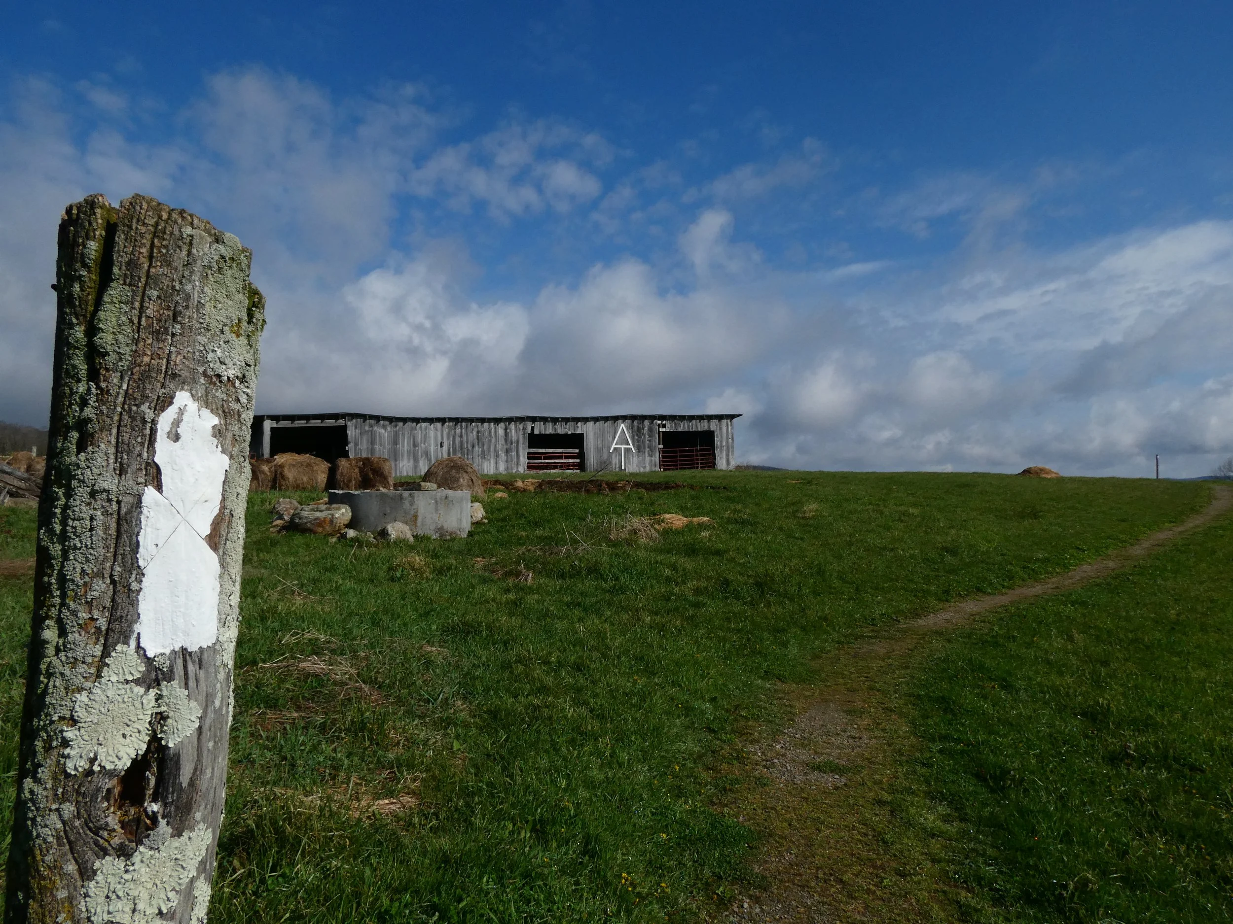
As I entered the rolling fields, I could see Lighthouse a little ways ahead of me. Immediately, the most notable landmark was a low barn with a giant AT symbol gracing its edifice. It was a cool site to see, especially because it seemed to be still in use. The fields themselves also seemed to be actively used for cattle grazing, because although I couldn’t see any bovines, they had left plenty of fecal landmines.
The morning was breezy, but the sun kept me warm as I hiked. After about a mile of gorgeous pasture and a couple cattle fences, I re-entered the woods. I soon caught up with Lighthouse, who was taking a break by the side of the trail. We stopped to chat and he told me about his troubles finding the right shoe for his thru-hike. He’d already been through a couple brands and models, including New Balance, Altra, and now Hoka. He seemed to be liking his new Hokas, especially given their extra support. We also chatted about sore feet, and Lighthouse explained that he had been using a golf ball to massage his feet every night. He told me that a guy at an outfitter had given it to him and that it had been helpful. He actually had ordered a dedicated Rawlogy cork massage ball, which he would be picking up in Damascus.
I hiked on another half mile or so and stopped to eat my big breakfast next to a piped spring just off the trail at mile 451.2. As I was eating, Lighthouse passed and then Delta arrived just as I was finishing my meal. I started hiking with Delta and after 4.5 miles we crossed US 421 at Low Gap, making snarky comments about the cars parked at the trailhead parking lot. About a mile later, we stopped for lunch near Locus Pole Knob. After another 2.6 miles, we passed McQueen’s Knob Shelter, a quaint little shelter apparently built in 1934. Guthook called it a “lean to” that “should only be used in emergencies.” Delta and I thought it was pretty cute.

McQueen’s Knob Shelter is a really old, tiny shelter with room for one or two hikers. My navigation app called it a “lean to” that “should only be used in emergencies”
About 1.4 miles later, we reached Abingdon Gap Shelter which is the last water source for 8 miles. Unfortunately, the piped spring was located 0.2 miles down a very steep side trail. On my way down to collect water, I stopped to dig a cathole. I then gathered water and Delta and shared a short break. We had about 6.5 miles to go until the Tennessee/Virginia border, and then another 1.5 miles until the water source/unmarked campsite where we planned to spend the evening. After a quick rest, we hiked on.

The trail was easy on us and we made great time following the rolling ridge. Soon enough, we caught site of the border sign and released a series of celebratory woops, hollers, and yawps! Making it to Virginia is a big deal. After nearly 500 miles, we were now entering the longest continuous state of the AT. We had many miles on our feet, but we still had many, many more. It was exciting and also a bit humbling to cross the Tenessee/Virginia border. I was reminded of a term that circulates in thru-hiker circles: “the Virginia blues.” It refers to the tendency of thru-hikers who make it this far to quit their thru-hike somewhere in Virginia. The idea is that the initial thrill of a thru-hike wanes by the time hikers reach Virginia. For some, the trail becomes a depressing cycle of sleep, walk, eat, repeat. The Virginia blues were certainly in the back of my mind as I admired the border sign, but they were mostly eclipsed by my anticipation for the things the lay ahead. The Grayson Highlands, McAfee Knob, and Shenandoah National Park were all in Virginia. I wasn’t too worried about the Virginia blues.

Tennessee | Virginia

After another 1.5 miles, we reached the water source/campsite and found Excel, Puddin, and Clover already set up for the evening. By simple coincidence they had developed the same plan and we all agreed to wake up a bit early to hike into Damascus for breakfast at the diner. Given that we were only about 1.7 miles outside of Damascus, we should be able to easily make it to the diner right when they open, which should help us avoid the inevitable morning rush of thru-hikers who had spent the night in town. It was a fun evening reconnecting with the crew after a couple days and I fell asleep with thoughts of pancakes, eggs, and bacon dancing around in my head🤤